Photo Entry by Scott Walker
Rocks are a symbolism of strength and the unmovable.
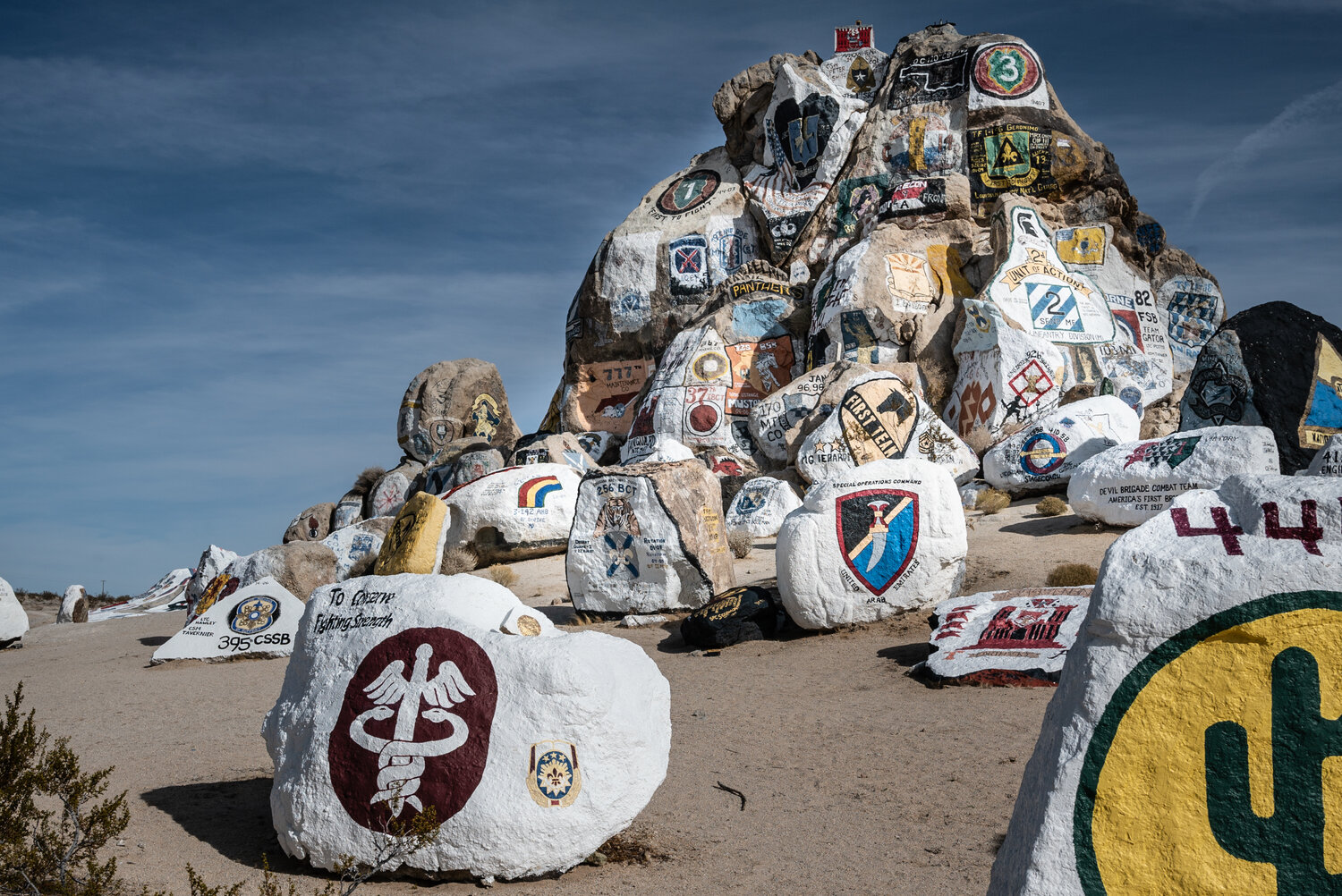
These rocks, some granite, are painted by the troops that receive specialized training in the desert at Fort Irwin in California. Each rock is hand painted by units that come in and exit by the hundreds and sometimes thousands.
The training that takes place at Fort Irwin prepares soldiers for the battlefield in places like Afghanistan, Iraq, Syria and other desert land countries. There is even a large city built within the 7 square miles of Fort Irwin that resembles cities in the Middle East.
Rocks seen in these photos are at the Entrance of the Fort Irwin National Training Center, which is also known as a census-designated place in the Mojave Desert. A “Census Designated Place” is defined by the United States Census Bureau as a rural area that does not have legal status and may not correspond with the local understanding of the community in the same area.
Fort Irwin is not a new base and has a 15,000 year history filled with Native Americans. During the gold rush, the land was under an encampment of Captain John C. Freemont, the first member of the U.S. Army to utilize the land. The camp was a stopping point for pioneers crossing the Mojave Desert and allowed those passing through to stop for water and rest.
By 1855 the land was part of the route that freight wagons took from Los Angeles to Salt Lake City, Utah. The Army patrolled the Fort Irwin area in the 1800's to ensure that raids and horse theft was not an issue, which it was in outlying areas.
The discovery of borax on the lands led to mining and some development.
In 1940, President Roosevelt established a 1,000 square mile “Mojave Anti Aircraft Range” in the area. In 1942, the desert land was officially named Fort Irwin in honor of Major General LeRoy Irwin, commander of the 57th Field Artillery Brigade during World War I.
SEE MORE at SmallTownBigWorld.com or visit the WGNS Photo of the Day.

